Show Mobile Navigation
Powered by Blogger.
Island
Showing posts with label Island. Show all posts

Tuesday, 14 October 2014

Wall of Tears, Mount Waialeale, Hawaii

WTH - Tuesday, October 14, 2014
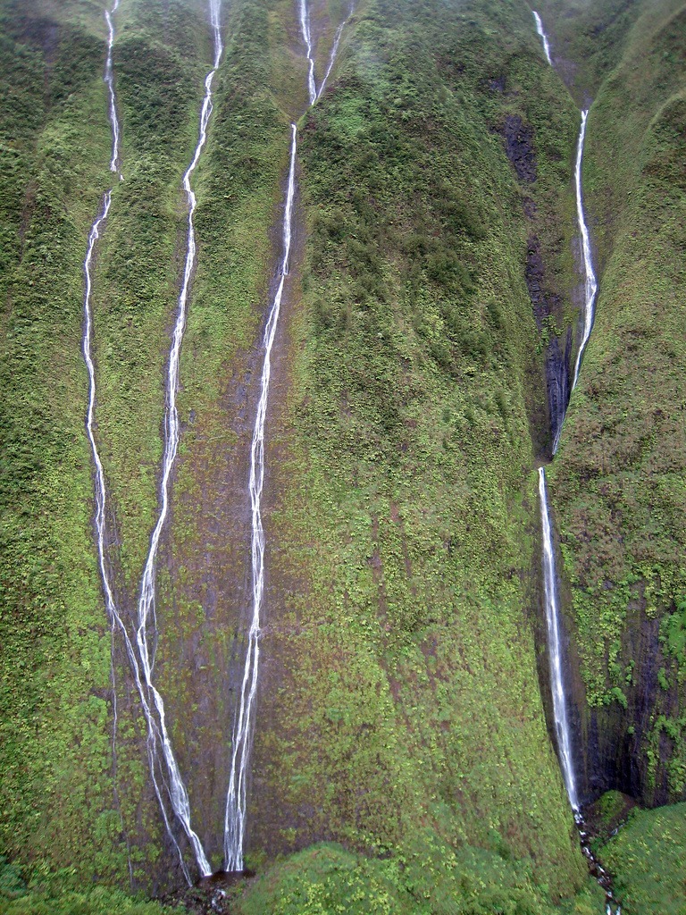
Mount Waialeale (or Wai'ale'ale) is a volcanic crater and the second highest point on the island of Kauai in the Hawaiian Islands. In the Hawaiian language, Wai'ale'ale means “rippling water” or “overflowing water.” Averaging more than 452 inches (11,500 mm) of rain a year since 1912, with a record 683 inches (17,300 mm) in 1982, its summit is one of the wettest spots on earth. As this rainwater makes its way down the 5,148-feet tall peak, they form innumerable streams. One spot on Mt. Waialeale is called the “Wall of Tears” because there are so many waterfalls plummeting down the deep, tropical green sides of the mountain that it looks as if it is crying.

Mount Waialeale isn’t easily accessible on foot. The sides are near vertical and ground is covered with trees and plants with a thick undergrowth of ferns. There are a few hiking trails in the area. The only way to really see the Wall of Tears is by helicopter, and even then you have to get lucky since the area is usually shrouded with clouds.

mt-waialeale-6

There are several reasons why Wai'ale'ale receives so much rain. First, Kauai is the northernmost of the main Hawaiian Islands, so it has more exposure to frontal systems that bring rain in the winter. Second, Wai'ale'ale has a round and conical shape, which exposes all sides of its summit to moisture-laden winds. Third, its summit lies just below the trade wind inversion layer of 6,000 feet (1,829 m), above which trade-wind-generated clouds cannot rise. And finally, the mountain's steep cliffs cause the humid air to rise quickly over 3,000 feet (910 m) in less than a half mile (800 m) and drop a large portion of its rain on one spot.

The summit itself is rather barren, despite all the water it receives. One of the reasons for that is that few plants and trees can handle that much rain. Also, since the summit is shrouded in clouds on most days of the year, little sunshine reaches the ground to foster plant growth. However, fungi and lichen flourish here.

mt-waialeale-5
mt-waialeale-1
mt-waialeale-2
mt-waialeale-3
mt-waialeale-7
mt-waialeale-8
mt-waialeale-9

Sources: WikipediaTo-Hawaii

Thursday, 2 October 2014

Where the Namib Desert meets the Sea

MY GID - Thursday, October 02, 2014
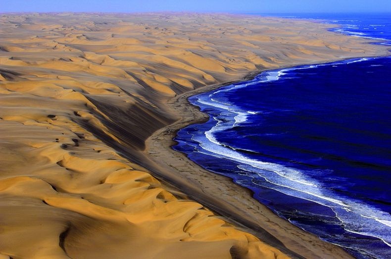
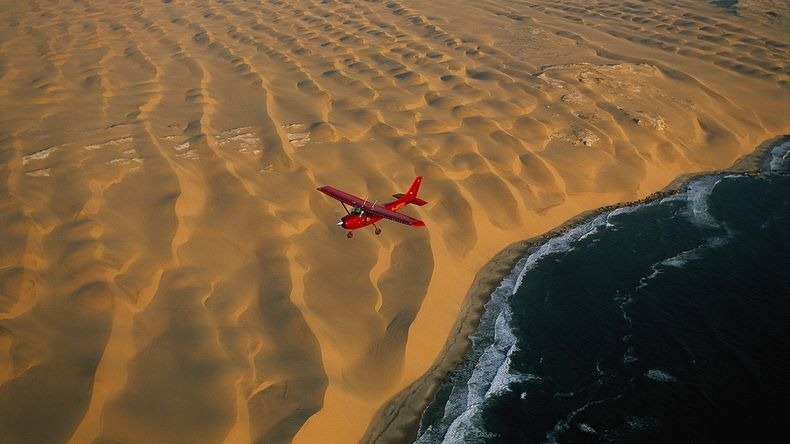
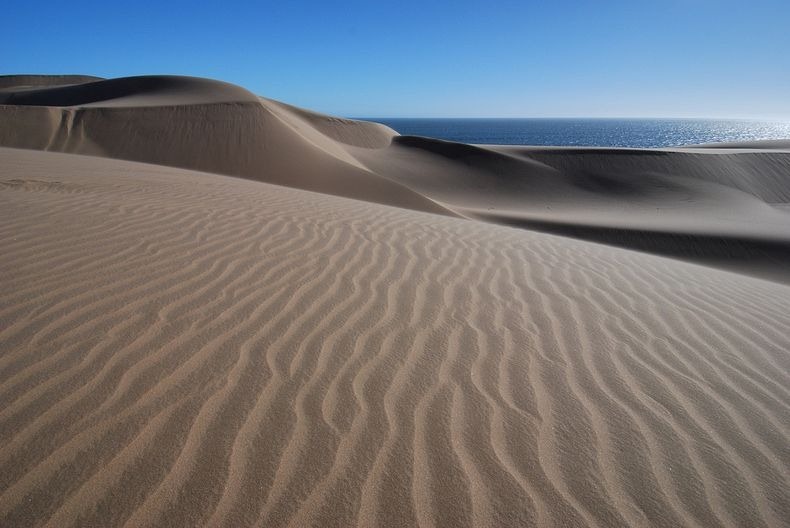
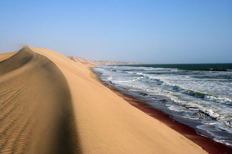
The Southern Namib desert is home to some of the tallest and most spectacular dunes of the world, ranging in color from pink to vivid orange. These dunes continue right to the edge of the Atlantic Ocean. The cold waters of the sea brushing against the dunes of the Namib desert is one of the most surreal sights.

While the sea coast extends for hundreds of miles, one of the best places to see these dunes is at Swakopmund. Known as Swakop in Namibia, it is the country's biggest coastal town and a mecca for Namibians on holiday. The city's German origins are quite pronounced in beautiful old German Colonial buildings throughout the city, making an even starker contrast for this town sitting at the edge of the Namib Desert.

From here, helicopter ride is available that flies you around the Skeleton Coast and the Namib desert in general.

namib-desert-meets-sea-11
namib-desert-meets-sea-1
namib-desert-meets-sea-10
namib-desert-meets-sea-2
namib-desert-meets-sea-3
namib-desert-meets-sea-4
namib-desert-meets-sea-5
namib-desert-meets-sea-6
namib-desert-meets-sea-7
namib-desert-meets-sea-9

Wineglass Bay in Australia

MY GID - Thursday, October 02, 2014
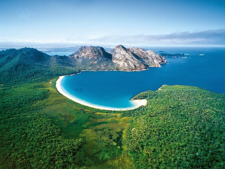
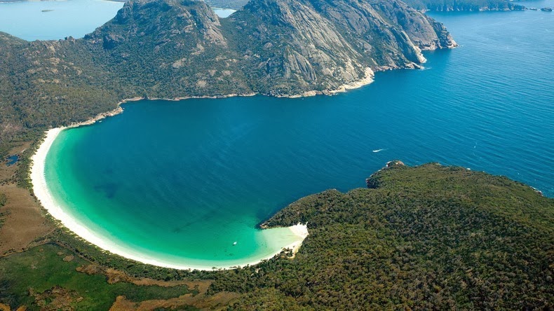
Located on Tasmania’s Freycinet Peninsula, Wineglass Bay is one of the most photogenic beaches in Australia. This crescent-shaped beach of dazzling white sand and sapphire-coloured sea is considered among the top ten beaches in the world.

Wineglass Bay is a good hour’s hike from the Parsons Cove car park, but it’s from the saddle track over the jagged granite peaks called “The Hazards”, that one can have the best view. From this vantage point you can see the beautiful curving, brilliant white sand beach, with a foreground of bright blue water, and background of dense green vegetation.

wineglass-bay-1

The beach itself is 1.7 km long and curves round in a northeast-facing arc. Waves are relatively low averaging 50 cm to 1 m in height and decreasing into the southern corner. They surge up a steep, white sand beach face, with no bar and deep water right off the beach. The beach is backed by a low vegetated dune, which forms the eastern side of the 1.5 km wide isthmus bordered in the west by Hazards Beach. Indigo Creek occasionally drains across the more protected southern end of the beach, with boats often moored off the corner.

To the south of Wineglass Bay are 20 km of exposed steep, rugged, pink and grey granite shoreline bordered by 100m high Cape Forestier in the north and 60 m high Cape Degerando to the south.
Winglass Bay is a great location for fishing, sailing, bushwalking, sea kayaking, rock-climbing, or simply soaking up the spectacular coastal scenery. With secluded sandy beaches, luxurious eco-lodges, it has become a favourite honeymoon destination for couples to escape and relax away from the rest of the world.

wineglass-bay-7
wineglass-bay-8
wineglass-bay-5
wineglass-bay-2
wineglass-bay-3
wineglass-bay-4

Sources: BeachsafeWikipedia

Horizontal Waterfalls in Talbot Bay, Australia

MY GID - Thursday, October 02, 2014
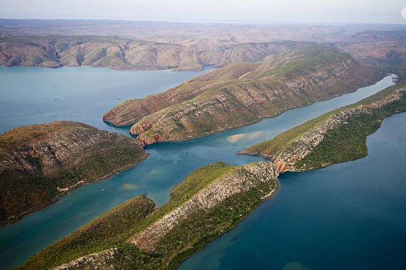
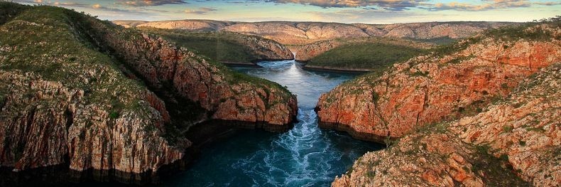
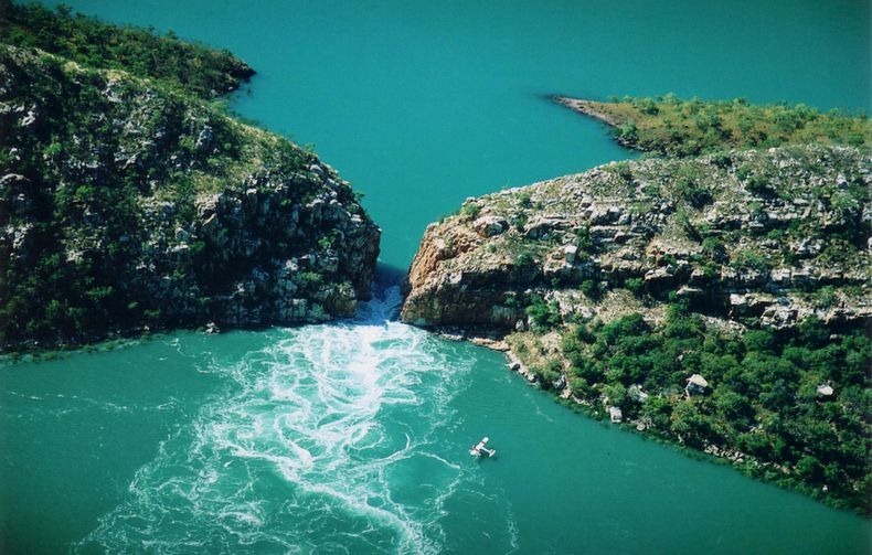
The Horizontal Falls or Horizontal Waterfalls are located in the Talbot Bay in the Kimberley region of western Australia. Although called waterfalls, this natural phenomenon actually consist of a pair of openings or gorges in the McLarty Range through which massive amount of water are pushed by tidal waves, creating temporary waterfalls up to 5 meters high. When the tide changes, so does the direction of the flow.

The twin gaps are located on two ridges running parallel approximately 300 meters apart. The first and most seaward gap is about 20 meters wide and the second, most spectacular, gap is about 10 meters wide. When the rising or falling tide occurs, the water builds up in front of the gaps faster than it can flow through them. This in turn creates an amazing waterfall effect as the water rushes through and then down to the lower levels on the other side of the ridgelines. The process is reversed and it is repeated again in the opposite direction.

horizontal-falls-9

The tides in this area have a 10 meter variation which occurs over six and a half hours from low tide to high tide and vice versa. On a slack tide it is possible to drive boats through the two gaps to the bay behind.

The waterfall phenomena has been described by David Attenborough as "one of the greatest natural wonders of the world".

horizontal-falls-1
horizontal-falls-3
horizontal-falls-5
horizontal-falls-6
horizontal-falls-7
horizontal-falls-8

Bioluminescence in Gippsland Lakes, Australia

MY GID - Thursday, October 02, 2014
The Gippsland Lakes are a network of lakes, marshes and lagoons in east Gippsland, Victoria, Australia covering an area of about 600 square kilometer. In the summer of 2008, an unusually high concentration of Noctiluca scintillans, a bioluminescent microorganisman, turned the waters a bright, glowing blue. Photographer Phil Hart happened to be there to document the amazing display.

Noctiluca scintillans, also known as “sea sparkle,” “sea fire,” “sea ghost”, are a species of dinoflagellate that feed on algae, plankton and bacteria. In December 2008, unusually heavy rain followed by floods caused a high concentration of blue-green algae called Synechococcus in the waters that prompted a higher-than-usual population of N. scintillans in the Gippsland Lakes. It is believed the combination of bush fires and floods created the high levels of nutrients in the lakes for the organisms to feed.


N. scintillans uses its bioluminescence as a defense mechanism, lighting up when it senses a predator coming near. The ghostly glow attracts even larger predators to eat the first predator, keeping the N. scintillans.
Using a long exposure on his camera, Hart had his friends splash in the water to light up and spread the bioluminescent organisms around. In other photos, Hart put his camera on a very slow shutter speed and threw sand and pebbles into the water to activate the glow.

During the remainder of 2009, the Gippsland Lakes returned to “better health" and the water turned cleaner and clearer, as the life cycle of the algae exhausted the nutrient supply from the sequence of fires and floods that started in late 2006. Phil Hart days that bio-luminescence might be visible in the lakes again but it may be a lifetime before it matches this vivid outburst of December 2008 and January 2009.

bioluminescence1

bioluminescence2
bioluminescence5

bioluminescence4

bioluminescence7


bioluminescence8
[via Webecoist]

Sunday, 21 September 2014

Whale Hunting in Faroe Islands Leave Sea Blood Red

MY GID - Sunday, September 21, 2014
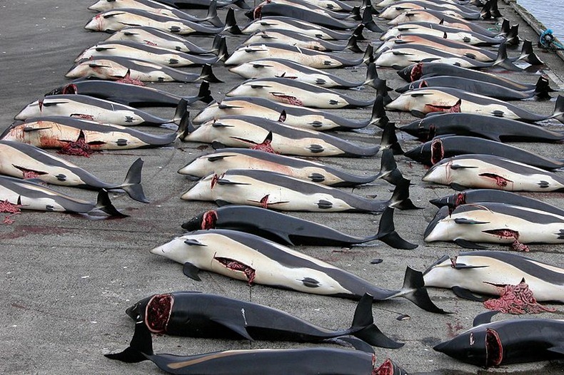
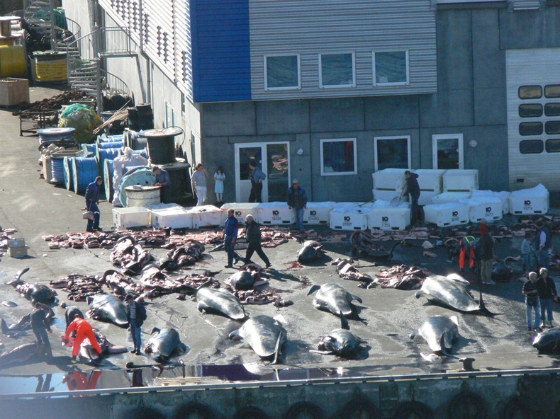
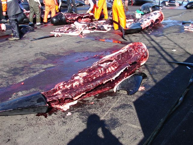
The sea of Faroe Islands in north of Europe turned red with the blood of hundreds of whales killed by the inhabitants on November 22, as a part of their annual whale hunting culture. Every year the islanders catch and slaughter pilot whales (Globicephala melaena) during the traditional whale hunt known as 'Grindadrap'.

The mass hunting is non-commercial - the whale meat cannot be sold but is divided evenly between members of the local community. The hunters crowd the whales into a bay and then cut their spines leaving the animals bleed to death slowly, while the surrounding sea turns bloody red. These images of a blood-red sea can often have a shocking effect on bystanders.

whale-hunting-11

Being an autonomous province of Denmark, where whaling is banned, the Faroe Islands’ laws allow the mass slaughter of pilot whales, beaked whales and dolphins to observe the annual tradition. 

Whaling in the Faroe Islands in the North Atlantic has been practiced since about the time of the first Norse settlements on the islands. The meat and blubber of pilot whales have long been a part of the islanders' national diet.

Despite criticism from animal rights groups and International Whaling Commission, the whale hunting custom continues to kill thousands of whales year after year. Around 950 Long-finned Pilot Whales are killed annually, mainly during the summer.

The American Cetacean Society says that pilot whales are not considered to be endangered, but that there has been a noticeable decrease in their numbers around the Faroe Islands.

whale-hunting-12
Photo credit: Andrija Ilic / Reuters
whale-hunting-3
Photo credit: Andrija Ilic / Reuters
whale-hunting-4
Photo credit: Andrija Ilic / Reuters
whale-hunting-5
Photo credit: Andrija Ilic / Reuters
whale-hunting-6
Photo credit: Andrija Ilic / Reuters
whale-hunting-2
whale-hunting-8
whale-hunting-7
whale-hunting-9
whale-hunting-13

Source: 12
Previous
Editor's Choice