Show Mobile Navigation
Powered by Blogger.
Latest In

Sunday 1 February 2015

Simple burial in Unmarked grave King Abdullah Saudi

Unknown - Sunday, February 01, 2015


Saudi Arabia's King Abdullah, one of the richest men in the history of the world, was carried in a simple white shroud to an unmarked grave on Friday in a Riyadh cemetery where many of his commoner subjects rest, in keeping with ascetic traditions.

The Saudi state school of Wahhabi Sunni Islam holds ostentatious displays of grief or mourning to be sinful, akin to idolatry.

There was no official mourning period in Saudi Arabia and flags around the kingdom all flew at full staff. Despite his apparent popularity among his subjects, there were no spontaneous gatherings on city streets to mark his passing.

Government offices, closed for the Middle East's normal Friday-Saturday weekend, will open as usual on Sunday.

While the afternoon prayer that preceded Abdullah's burial took place before ranks of Muslim leaders, Saudi princes, powerful clerics and billionaire Arab businessmen, his body was transported to the mosque in a city ambulance.

It was borne through the crowds on a carpet on a simple stretcher, laid in front of the faithful at prayer and then carried by Abdullah's male relatives to the graveyard, where it was laid in the ground with no ceremony.


Thursday 4 December 2014

Bibi Ka Maqbara: The Other Taj Mahal

Unknown - Thursday, December 04, 2014
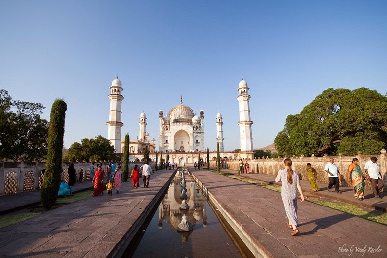
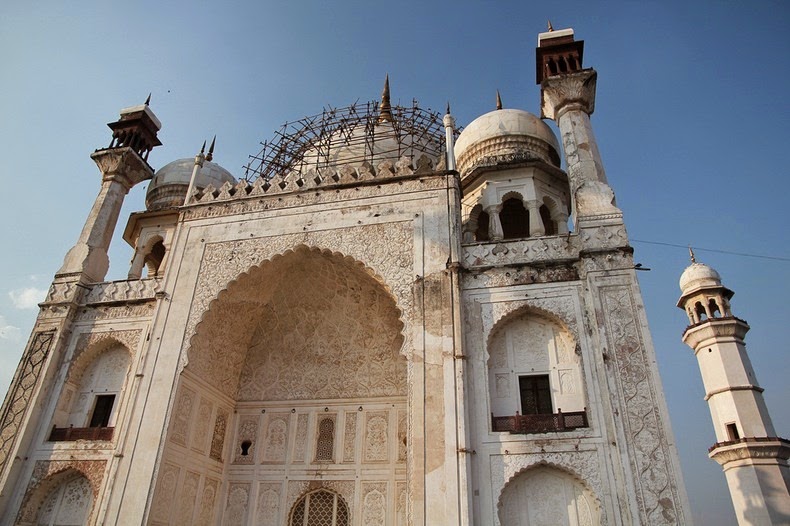
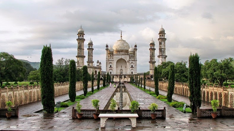
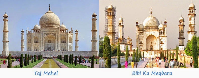
Do you know that India has not one but two Taj Mahals? Indeed, there is a monument identical to the Taj that stands in Aurangabad in Maharashtra. It is a mausoleum called Bibi Ka Maqbara ("Tomb of the Lady") built by Prince Azam Shah, the son of the sixth Mughal Emperor Aurangzeb, between 1651 and 1661 A.D, in the memory of his mother, Dilras Banu Begum.

Bibi Ka Maqbara draws its inspiration from the famous Taj Mahal of Agra built by none other that Prince Azam Shah’s grandfather, Mughal Emperor Shah Jahan in memory of his wife Mumtaz Mahal. Azam Shah intended to build a monument that would rival the Taj Mahal. Unfortunately, he lacked the treasury his grandfather had access to, as well as the skilled labour the treasury bought, resulting in a poor copy of the latter. Even so, Bibi Ka Maqbara is an architectural wonder with intricate designs, carved motifs, imposing structure and beautifully landscaped Mughal-style garden. Due to its strong resemblance to the Taj Mahal, it is lovingly called the “Taj of the Deccan”.
bibi-ka-maqbara-11
This is not Taj Mahal. It’s Bibi Ka Maqbara. Photo credit

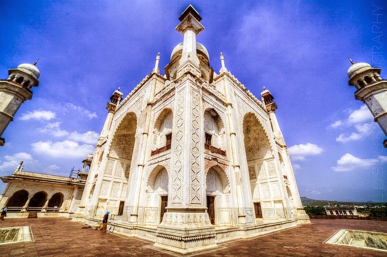
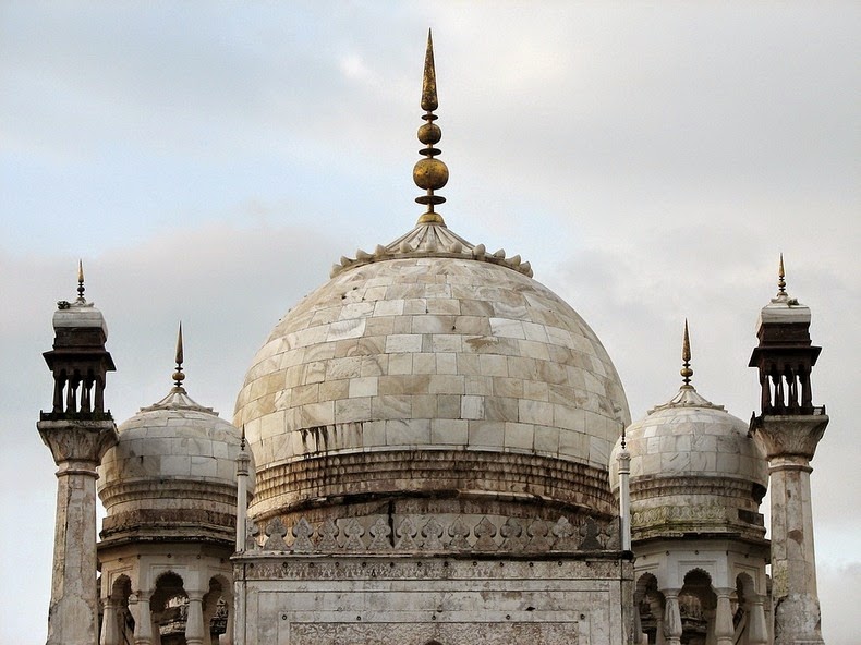
The mausoleum stands at the centre of a spacious enclosure measuring approximately 458 meters by 275 meters, with axial ponds, fountains, and water channels, many defined by stone screens and lined with broad pathways. The garden is enclosed by high crenelated walls with fortress set at intervals, and open pavilions on three sides. The mausoleum is built on a high square platform with four minarets at its corners, exactly like the Taj Mahal, and approached by a flight of steps from three sides. The main onion dome of the Maqbara is, however, smaller than the dome of the Taj and its minarets are shorter.

Seen by itself, Bibi Ka Maqbara is a beautiful piece of work, but it pales in comparison to its famous forbearer. While the monument in Agra is made entirely out of pure white marble, the mausoleum in Aurangabad is encased with marble only up to the dado level. Above this is covered with a fine plaster polished to give a marble-like finish. Only the onion dome was built with marble. The walls of the Maqbara are also a little dusky by contrast, which gives the mausoleum a duller appearance compared to the Taj. According to records, Bibi Ka Maqbara cost Alam Shah 700,000 Rupees to build. For comparison, the Taj Mahal was built at a cost of approximately 32 million Rupees at that time. This is probably another reason why Bibi Ka Maqbara is often referred to as the "poor man’s Taj".
bibi-ka-maqbara-taj-mahal

Bibi Ka Maqbara’s diminutive status is a consequence of Aurangzeb’s lack of interest in architecture. Initially Aurangzeb was not in favour of building a monument as lavish as the Taj, and he prevented its construction by blocking the movement of marble from Rajasthan and various other parts of the Mughal empire. But his son Alam Shah was determined to have a monument to his mother that might vie with the Taj. Somehow, Alam Shah prevailed upon his father who eventually relented.

Legend has it that in 1803, Nizam Sikander Jahan was so captivated by the Maqbara that when Aurangabad and the Marathwada area were annexed to his kingdom he planned to shift the Maqbara to his capital, Hyderabad. He even ordered dismantling of the structure, slab by slab. But, somehow, he had a premonition of some disaster which might befall him were he to harm the existing structure. He stopped the work and as a penance got a mosque built, which still stands to the west of the main structure.

bibi-ka-maqbara-9
bibi-ka-maqbara-3
bibi-ka-maqbara-7
bibi-ka-maqbara-10
bibi-ka-maqbara-2
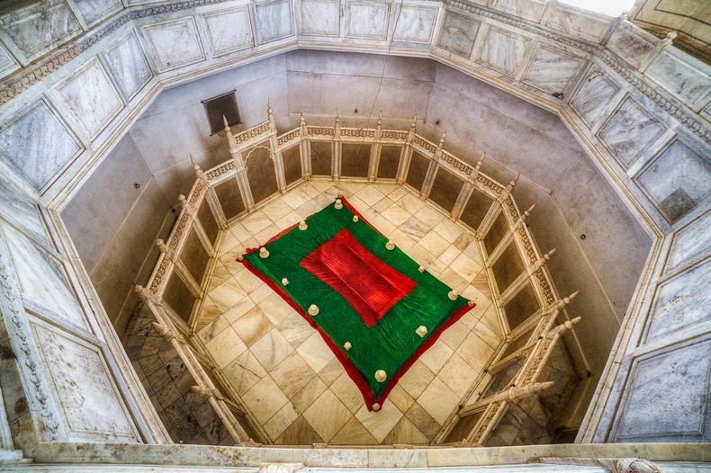
The tomb of Dilras Banu Begum. Photo credit
bibi-ka-maqbara-4

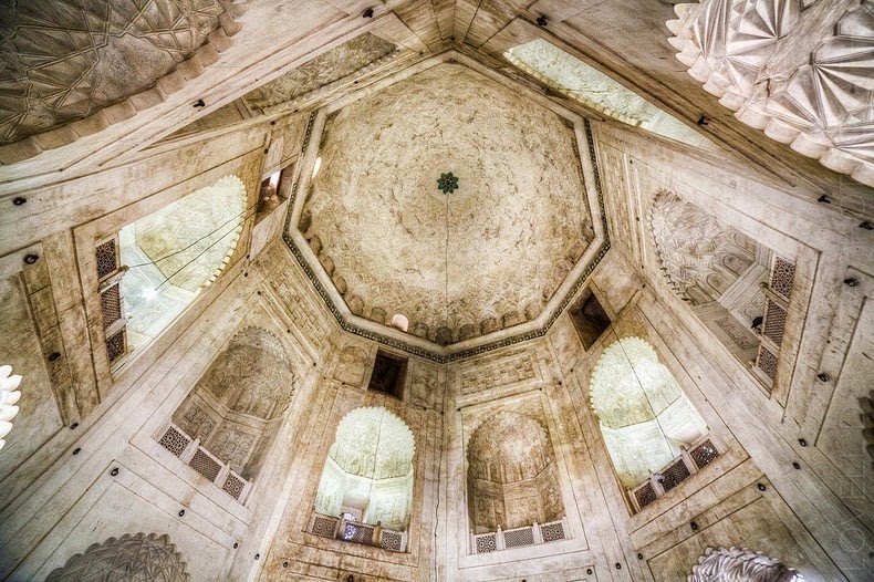
Symmetrical designs and balconies line the octagonal tomb enclosure. Photo credit

Pearl-Qatar, A Luxurious Artificial Island

Unknown - Thursday, December 04, 2014
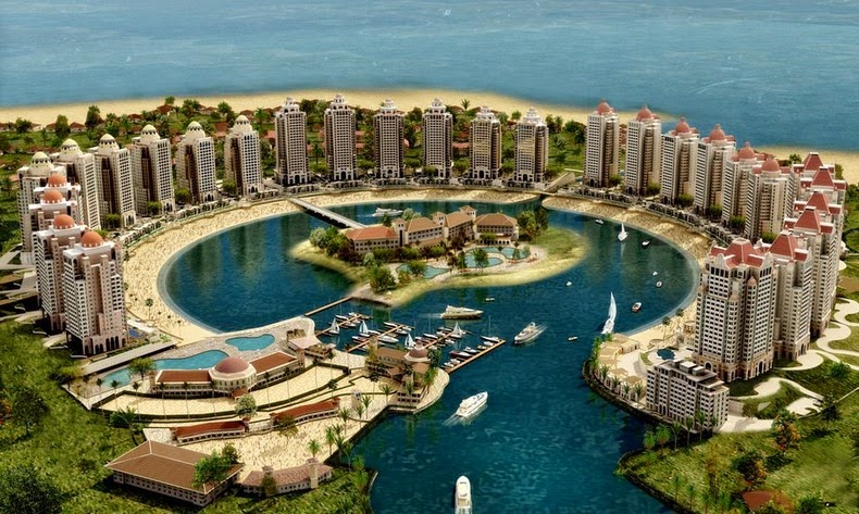
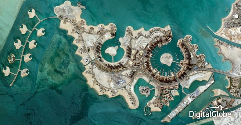
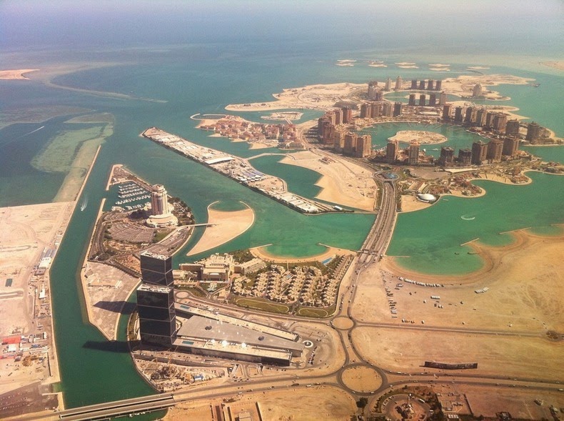
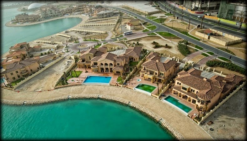
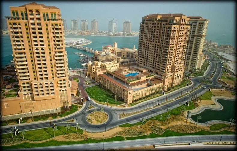
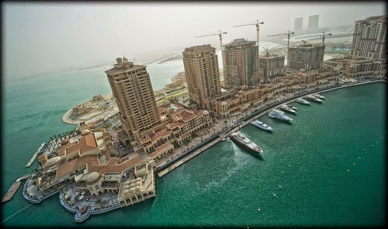
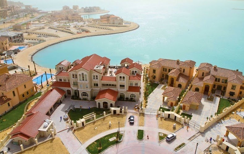
The Pearl-Qatar in Doha, Qatar, is a luxurious residential complex that is being developed on an artificial island, off the coast of Doha’s West Bay. The 4-square-km island created on reclaimed land has 32 kilometers of new coastline lined with private villas, dozens of apartments towers and hundreds of homes, along with luxury hotels and opulent stores and restaurants. As of spring 2012, more than 5,000 residents have already moved in. When construction completes by 2015, the island will have room for 41,000. The Pearl-Qatar is one of the most ambitious development project in Qatar, and the first development to offer freehold and residential rights to international clients.

The development’s name “Pearl” refers to the major pearl-diving industry that used to be based on the shallow seabed where the island is being built. Qatar was one of the major pearl traders of Asia before the Japanese introduced cheaper more affordable pearls just before Qatar's oil boom. The island’s design also resemble a string of pearls.

pearl-qatar-10

The Pearl-Qatar’s first phase and gateway to the Island boasts of the world’s longest waterfront luxury retail walkway, the 3.5 kilometer marina-front pedestrian boardwalk “La Croisette”, which is home to international hospitality brands and high-end boutiques. The large Porto Arabia district encompasses 31 apartment towers around a circular lagoon with a central island and a marina with space for 750 boats. 

There are also more than 400 town homes, over 6,000 parking spaces and extensive space for retail stores including a multitude of internationally renowned outlets. These include brands like Giorgio Armani, Hugo Boss, Roberto Cavalli and Elie Saab. There will also be a “Venice-like community” with extensive canal system, pedestrian-friendly squares and plazas and beachfront townhouses. There is even a replica of Venice’s Rialto Bridge.

When the project was first revealed in 2004, the initial cost of constructing the island stood at $2.5 billion. It is now believed the project will cost $15 billion upon completion.


pearl-qatar-2
pearl-qatar-1
pearl-qatar-6
pearl-qatar-7
pearl-qatar-8
pearl-qatar-9

Patrick Dougherty’s Twig Sculptures

Unknown - Thursday, December 04, 2014
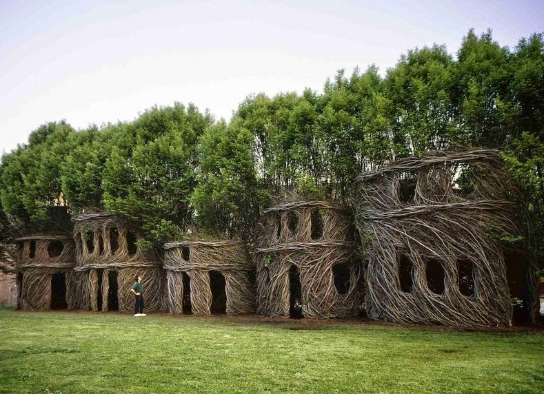
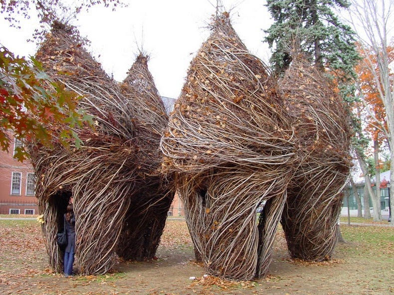
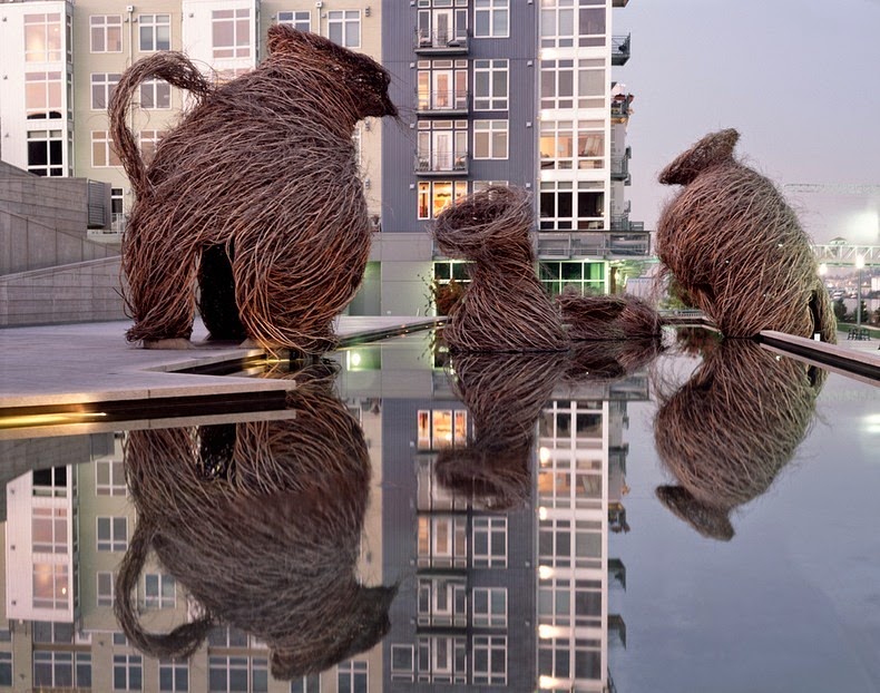
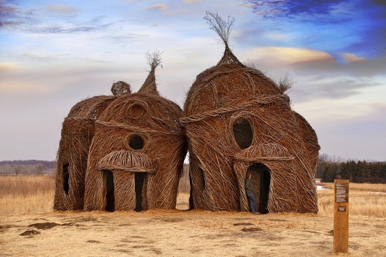
North Carolina-based artist Patrick Dougherty has gained an international reputation for weaving tree saplings into massive, swirling forms that resemble bird nests as high as 40 feet. His sculptures are temporary, owning to the nature of the materials used, and break down after a year or two in the wild.

A post-graduate in Hospital and Health Administration, Patrick started studying art history and sculpture at the University of North Carolina, where he began learning about primitive techniques of building, and applying his carpentry skills with his love of nature started to experiment with tree saplings as construction material. 

His first artwork was his house. Collecting fallen branches, rocks and old timber, Dougherty built a villa where he still lives with his wife and son. Incidentally, his house is his only permanent work. Over the last thirty years, he has built over 230 of these works, that have been seen worldwide---from Scotland to Japan to Brussels, and all over the United States.

patrick-dougherty-7
patrick-dougherty-2
patrick-dougherty-4
patrick-dougherty-5

patrick-dougherty-6

Sunday 30 November 2014

Exocoetidae: The Fish That Flies

Unknown - Sunday, November 30, 2014
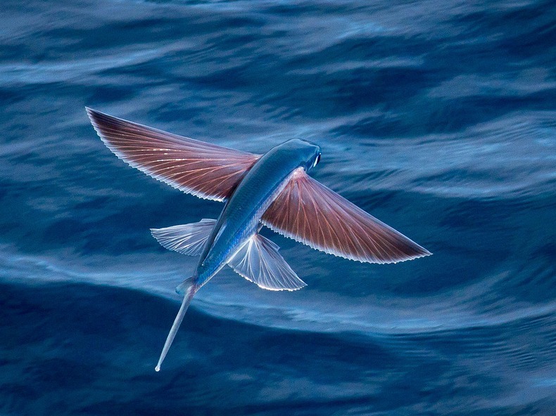
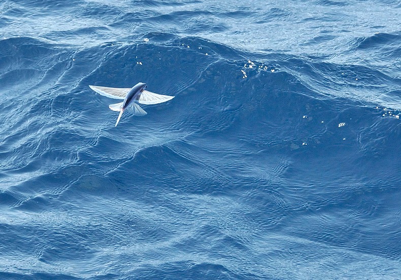
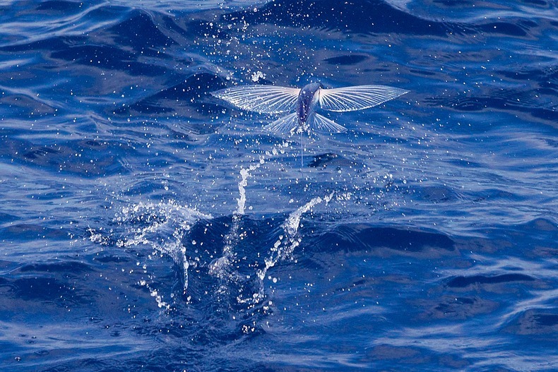
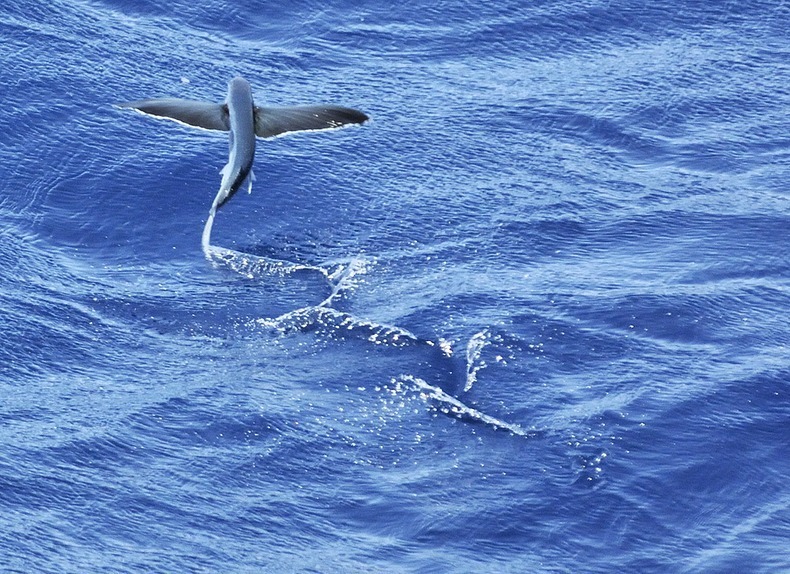
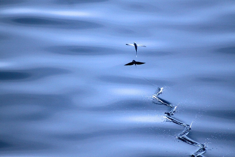
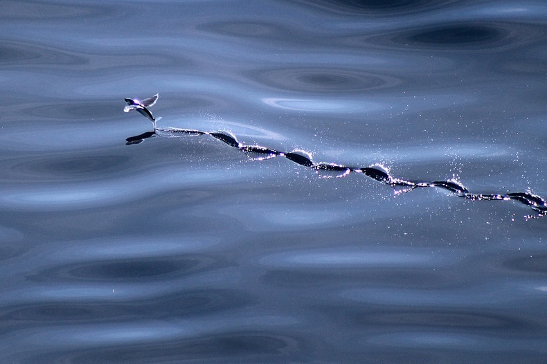
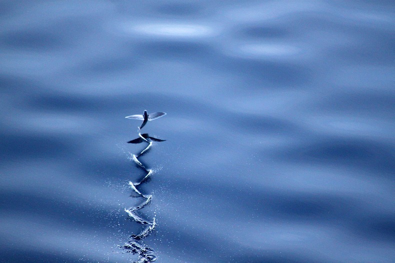
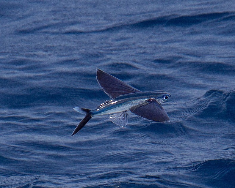
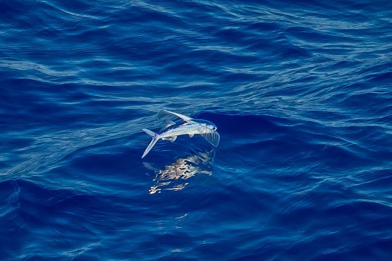
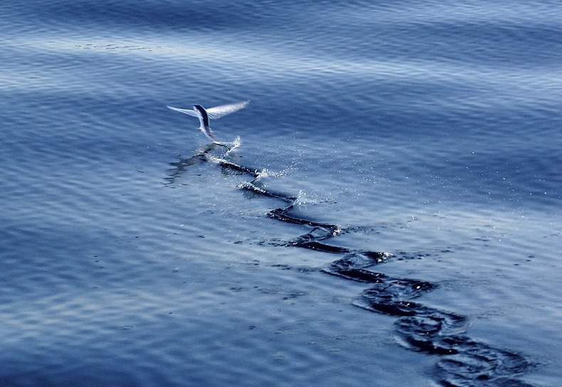
Exocoetidae, commonly called Flying Fish, is a family of fishes aptly named for their ability to emerge out of the water and glide for long distances with their outstretched pectoral fins. Their streamlined torpedo shape helps them gather enough underwater speed to break the surface, and their large, wing-like fins get them airborne. Once in the air, these fishes can glide over considerable distances. Their flights are typically around 50 meters, but some fishes have been recorded to fly up to 200 meters or more. Some species of flying fish have enlarged pelvic fins as well as enlarged pectoral fins, which allows them to fly further than two winged gliders (up to 400 meters), and have far greater maneuverability. These fishes are known as four-winged flying fish.

flying-fish-4

To glide upward out of the water, a flying fish moves its tail up to 70 times per second. It then spreads its pectoral fins and tilts them slightly upward to provide lift. At the end of a glide, it folds its pectoral fins to reenter the sea, or drops its tail into the water to push against the water to lift itself for another glide, possibly changing direction. The curved profile of the "wing" is comparable to the aerodynamic shape of a bird wing. The fish is known to take advantage of updrafts created by air currents to increase its time of flight.
Flying fish are thought to have evolved this remarkable gliding ability to escape predators, of which they have many. Their pursuers include mackerel, tuna, swordfish, marlin, and other larger fish. Unfortunately, this evasive maneuver is not enough to escape the biggest predator on earth – humans.
Flying fish is commercially fished in Asian countries such as Japan, Vietnam and China, including the Caribbean where it’s a coveted delicacy. In Japanese cuisine, the fish is used to make some types of sushi. It is also a staple in the diet of the Tao people of Taiwan. In Barbados, flying fish were threatened by pollution and overfishing, changing the occurrences of flying fish in the waters off of Barbados. This sparked a fishing controversy between Barbados, and Trinidad and Tobago.

flying-fish-3
flying-fish-11
flying-fish-12
flying-fish-1
flying-fish-2
flying-fish-5
flying-fish-6
flying-fish-7
flying-fish-8
flying-fish-9

Friday 31 October 2014

Shilin Stone Forest, China

MY GID - Friday, October 31, 2014
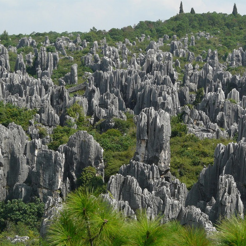
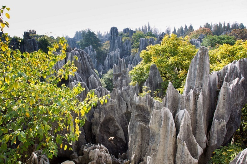
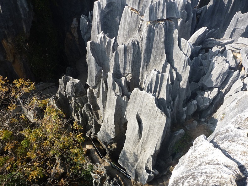
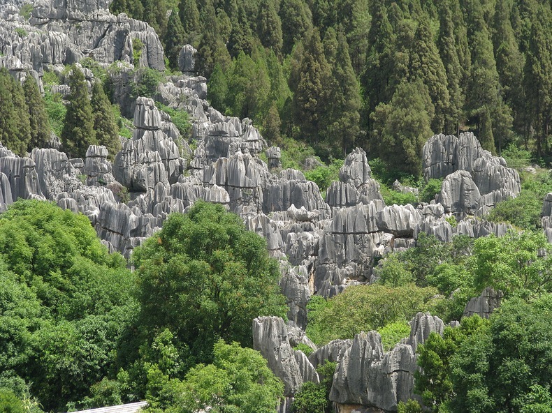
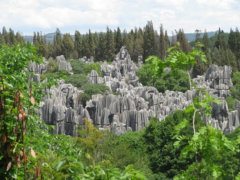
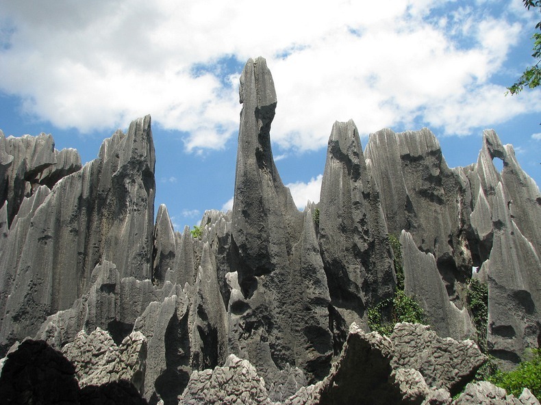
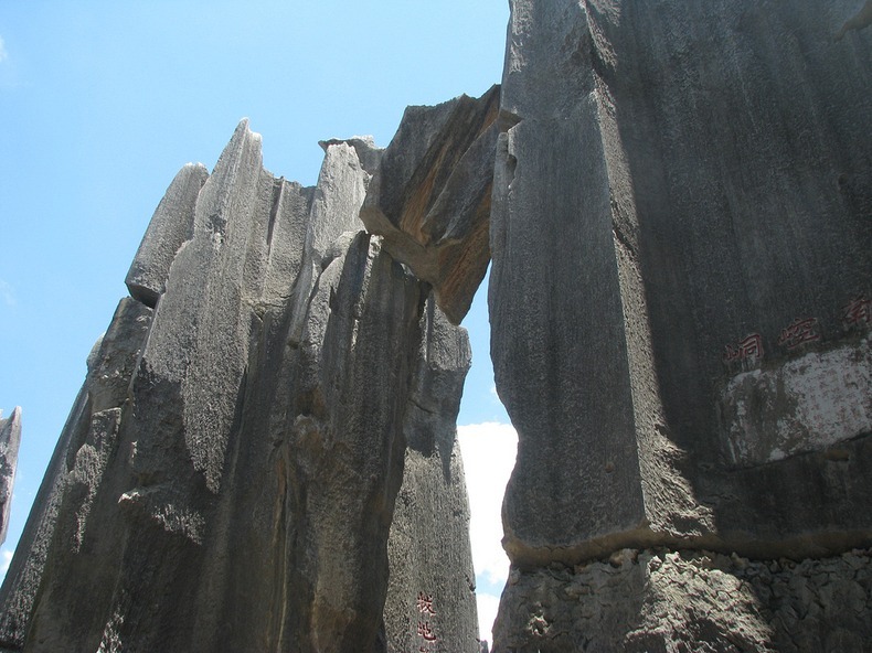
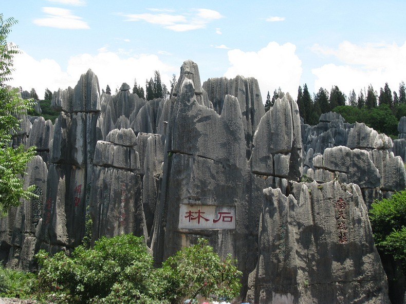
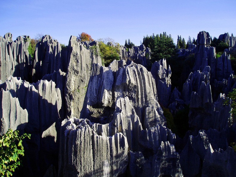
The Shilin Stone Forest is a set of spectacular limestone formations located in Shilin Yi Autonomous County, Yunnan Province, in China, approximately 120 km from the provincial capital Kunming. The tall rocks seem to emanate from the ground like stalagmites, with many looking like petrified trees thereby creating the illusion of a forest made of stone. 

Some of the stone formations are up to 30 meters tall.

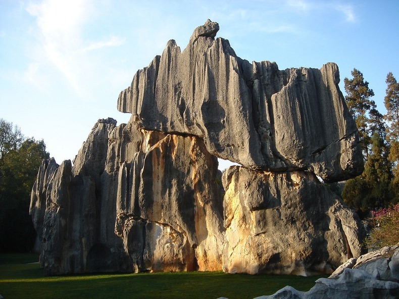
Over 270 millions years, abusive geological processes, and erosion by water has carved the limestone into shapes that we see today. The resulting formations are generally known as karst - a German term for the region in Slovenia where the process was first investigated.

shilin-stone-forest-3

The stone forest forms part of the South China Karst region that extends over a surface of half a million square kilometers lying mainly in Yunnan, Guizhou and Guangxi provinces. It represents one of the world’s most spectacular examples of humid tropical to subtropical karst landscapes. 

The Shilin Stone Forest displays superlative karst features and landscapes seen nowhere else in the world, with a wider range of pinnacle shapes than other karst landscapes, and a higher diversity of shapes and changing colours. There are pinnacle-shaped, column-shaped, mushroom-shaped, and pagoda-shaped groups. Since almost all the typical pinnacle karst types can be identified in the Stone Forest, the park is acclaimed internationally the "Museum of Stone Forest karst".

shilin-stone-forest-2
shilin-stone-forest-4
shilin-stone-forest-6
shilin-stone-forest-7
shilin-stone-forest-8
shilin-stone-forest-9
shilin-stone-forest-10
shilin-stone-forest-5
shilin-stone-forest-11
shilin-stone-forest-12
shilin-stone-forest-13

Tuesday 14 October 2014

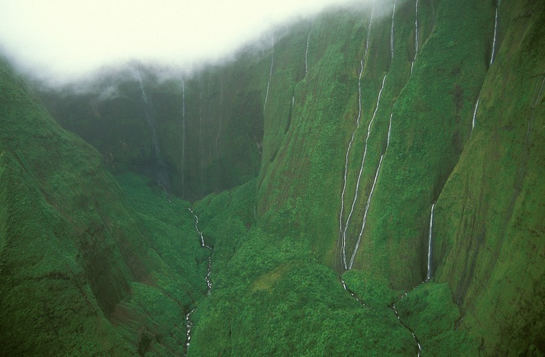
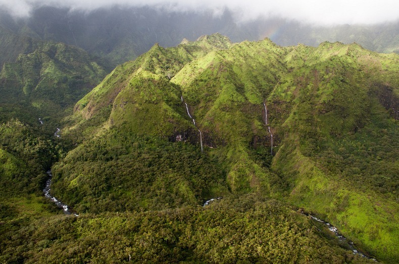
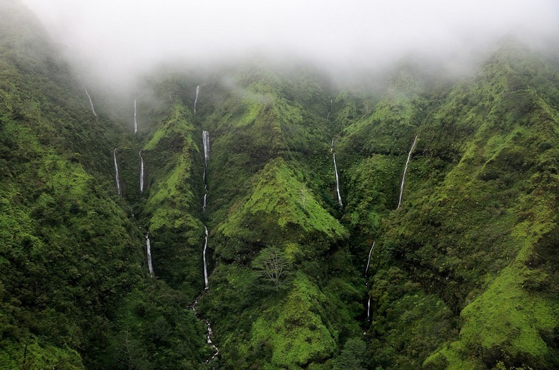
Wall of Tears, Mount Waialeale, Hawaii

WTH - Tuesday, October 14, 2014
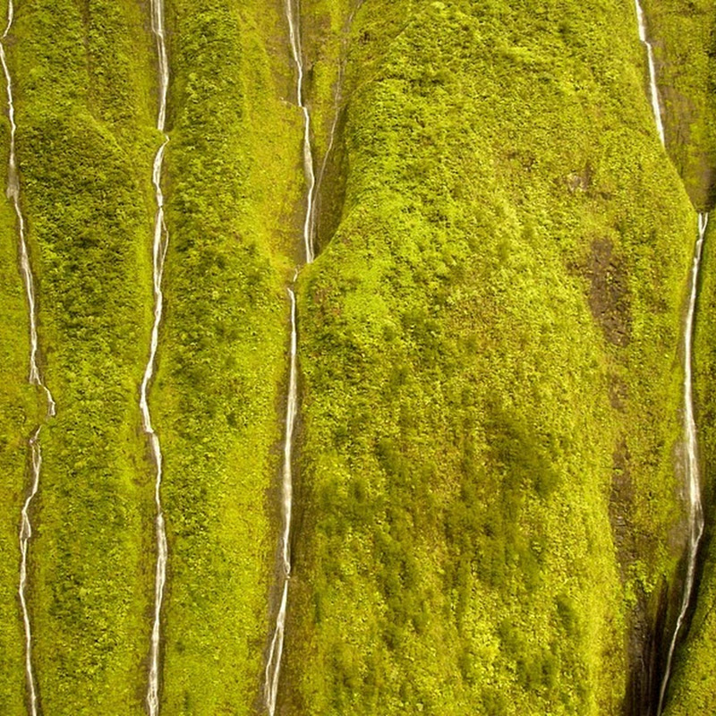
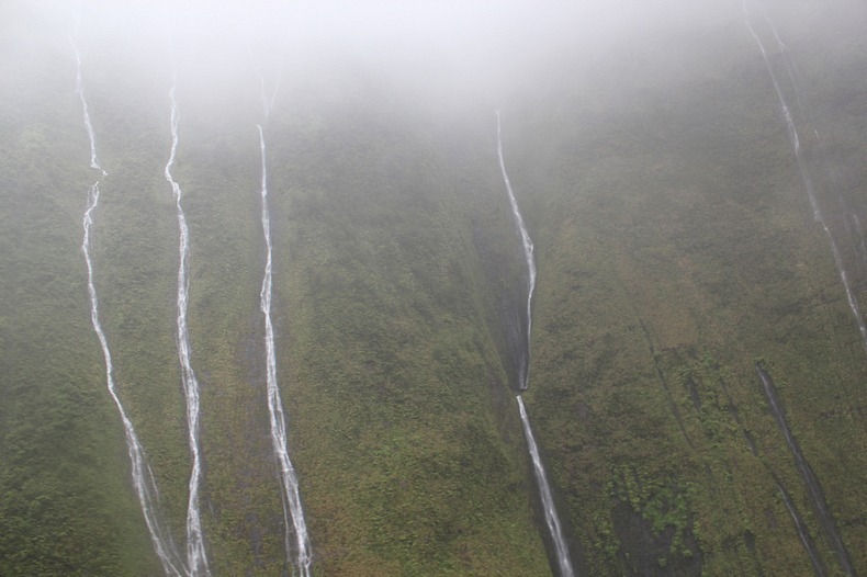
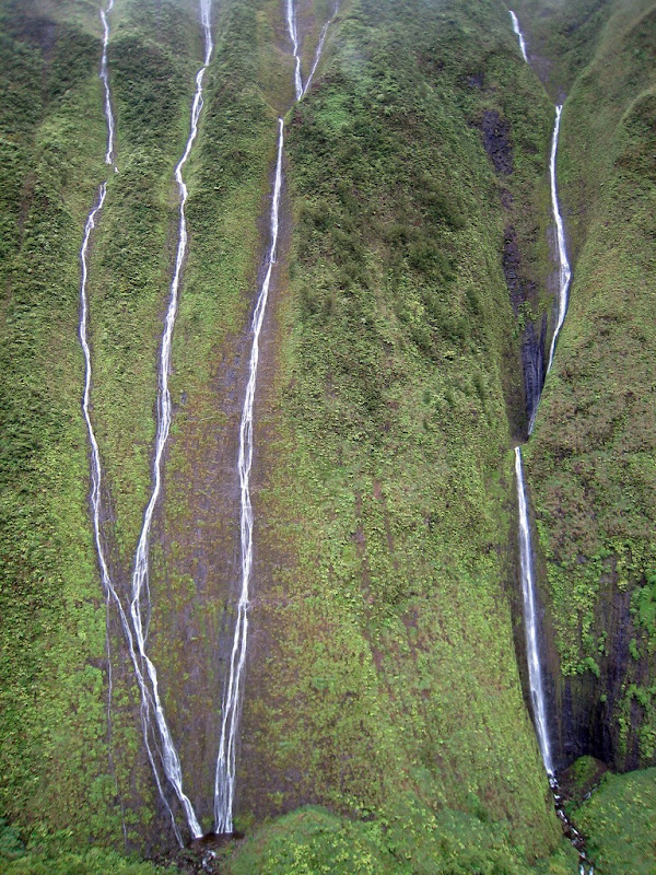
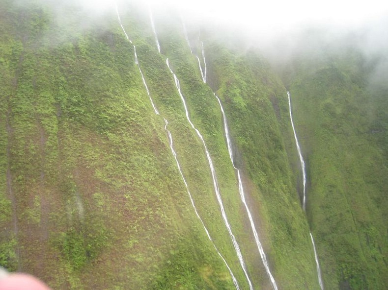
Mount Waialeale (or Wai'ale'ale) is a volcanic crater and the second highest point on the island of Kauai in the Hawaiian Islands. In the Hawaiian language, Wai'ale'ale means “rippling water” or “overflowing water.” Averaging more than 452 inches (11,500 mm) of rain a year since 1912, with a record 683 inches (17,300 mm) in 1982, its summit is one of the wettest spots on earth. As this rainwater makes its way down the 5,148-feet tall peak, they form innumerable streams. One spot on Mt. Waialeale is called the “Wall of Tears” because there are so many waterfalls plummeting down the deep, tropical green sides of the mountain that it looks as if it is crying.

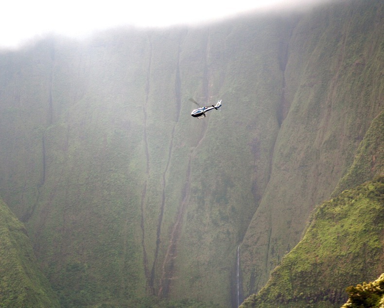
Mount Waialeale isn’t easily accessible on foot. The sides are near vertical and ground is covered with trees and plants with a thick undergrowth of ferns. There are a few hiking trails in the area. The only way to really see the Wall of Tears is by helicopter, and even then you have to get lucky since the area is usually shrouded with clouds.

mt-waialeale-6

There are several reasons why Wai'ale'ale receives so much rain. First, Kauai is the northernmost of the main Hawaiian Islands, so it has more exposure to frontal systems that bring rain in the winter. Second, Wai'ale'ale has a round and conical shape, which exposes all sides of its summit to moisture-laden winds. Third, its summit lies just below the trade wind inversion layer of 6,000 feet (1,829 m), above which trade-wind-generated clouds cannot rise. And finally, the mountain's steep cliffs cause the humid air to rise quickly over 3,000 feet (910 m) in less than a half mile (800 m) and drop a large portion of its rain on one spot.

The summit itself is rather barren, despite all the water it receives. One of the reasons for that is that few plants and trees can handle that much rain. Also, since the summit is shrouded in clouds on most days of the year, little sunshine reaches the ground to foster plant growth. However, fungi and lichen flourish here.

mt-waialeale-5
mt-waialeale-1
mt-waialeale-2
mt-waialeale-3
mt-waialeale-7
mt-waialeale-8
mt-waialeale-9

Sources: WikipediaTo-Hawaii
Previous
Editor's Choice